On July 15, ISPRA (the Italian Institute for Environmental Protection and Research) presented ARCADIA, a new oceanographic vessel, at the Chamber of Deputies in Rome. This ship is designed to explore the deep sea and tackle the challenges of climate change.
The vessel is part of the MER (Marine Ecosystem Restoration) project, the largest environmental investment under the Italian National Recovery and Resilience Plan (PNRR), with funding of €400 million. It is a major program implemented by ISPRA under the guidance of the Ministry of the Environment and Energy Security, aimed at mapping and restoring underwater ecosystems—often invisible, but crucial for climate regulation, biodiversity, and the economy.
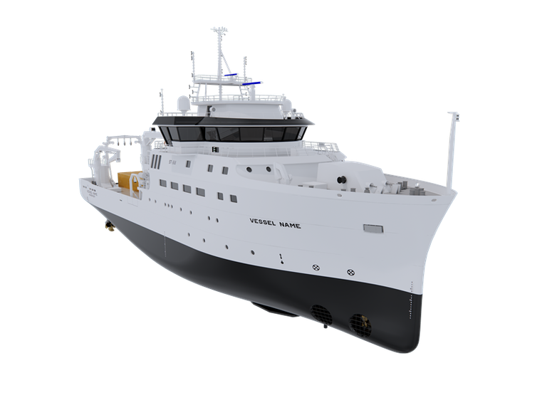
The ship is a state-of-the-art floating laboratory, designed to study, monitor, and protect the marine ecosystems of the Mediterranean Sea. Its main goal is to collect data, build scientific knowledge, and guide environmental policies toward a more sustainable future.
The vessel will be launched in June 2026 and is engineered to carry out extended oceanic missions. It is equipped with some of the most advanced underwater technologies currently available in Europe, including a specially designed hull component called a “gondola,” about 9 meters long, which houses numerous next-generation sensors and acoustic systems. This setup will allow for continuous, high-quality data collection even under extreme operating conditions.
Also on board is a ROV (Remotely Operated Vehicle) capable of operating at depths of up to 4,000 meters. It features 4K cameras, sonar, and 3D laser technology, enabling scientific missions in extreme environments such as geological explorations, biological surveys, and underwater infrastructure inspections. In addition, the ship carries an AUV (Autonomous Underwater Vehicle), which can conduct independent missions lasting over 60 hours and reaching depths of up to 3,000 meters.
The vessel will also be equipped with two auxiliary boats for coastal mapping: an electric catamaran with an unmanned surface vehicle (ASV) for mapping shallow, protected, and enclosed waters, and a secondary boat outfitted with sensors suitable for geophysical exploration.